Projects
Flower Garden Banks Deep Coral Reef in the Gulf of Mexico
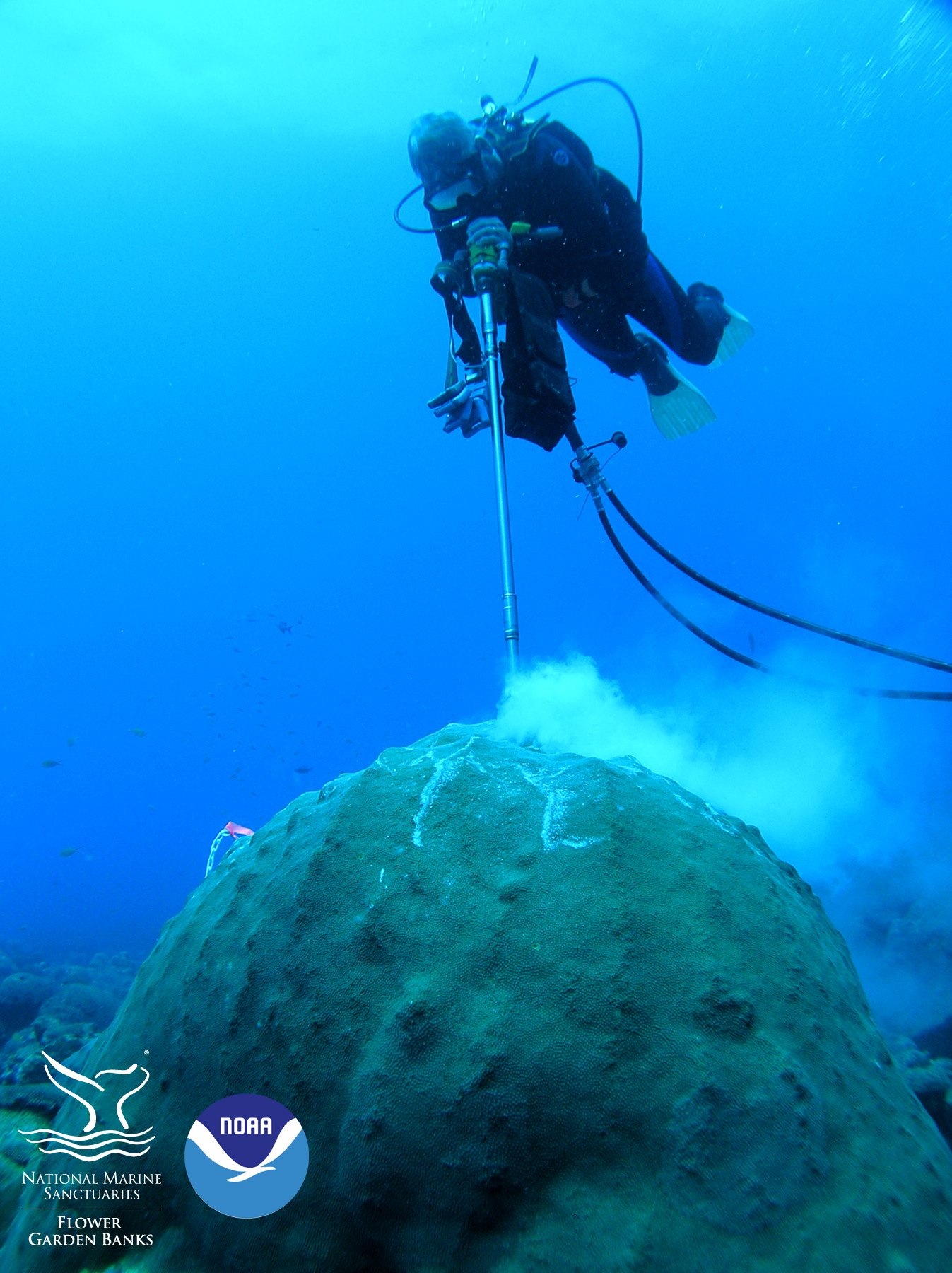
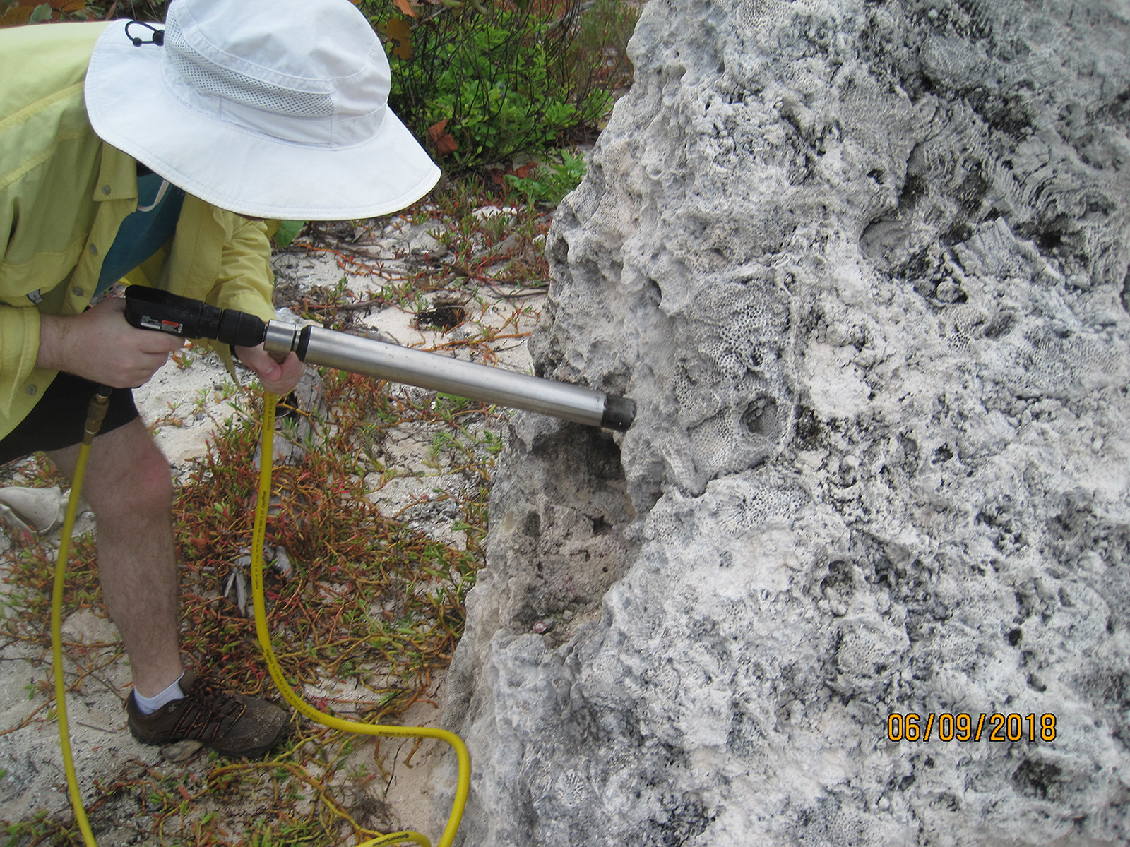
Drilling a coral in Flower Garden BanksNOAA
The PAST lab is working with Dr. Amy Wagner at Sacramento State University on rebuilding reconstructions with a Siderastrea siderea coral from West Flower Garden Bank (27.8⁰N, 93.8⁰W) located 185 km away from the Louisiana and Texas coast, far from terrigenous runoff and coastal upwelling. Visiting scholar, Mudith Weerabaddana from Sri Lanka, examined coral Ba/Ca and Sr/Ca for two time intervals before and during oil exploration in the Gulf (1929–1942 and 1976–2005) in this coral to better understand coral Ba/Ca and impacts for drilling muds used in oil exploration. He found regular seasonal cycles in the coral Ba/Ca are quasi-in-phase with sea surface temperature and thus coral Sr/Ca (a temperature proxy) but with a different seasonal pattern. The coral Ba/Ca lacks the large anomalies commonly seen in corals located in upwelling areas or near rivers since Flower Garden Banks is open ocean with no land near by. Chlorophyll-a concentration, an indicator of sea surface productivity, which varies seasonally in the Gulf of Mexico, negatively correlates with coral Ba/Ca suggesting 31.4% of the coral Ba/Ca seasonal cycle is explained by seasonal productivity. There is a significant increase in mean coral Ba/Ca of 1.76 ±0.40 (2σ) μmol/mol between the two time intervals examined. After the first offshore oil discovery in the Gulf of Mexico in 1947, large-scale operations escalated in the late 1970s. Offshore oil exploration uses barite (BaSO4) in drilling muds that are released into the seafloor as waste and thus could be the source for increased coral Ba/Ca and thus seawater Ba. Annual coral Ba/Ca from 1976–2005 corresponds to changes in annual barite consumption in the United States, where the northern Gulf of Mexico is the largest US oil field. Mudith defended his Masters project in September 2020 and will submitting this work for publication.
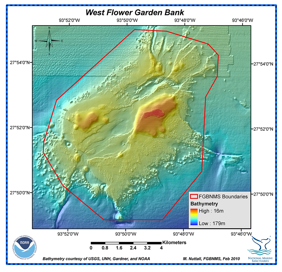
Map of West Flower Garden Banks where the coral was cored on the north side of the reefNOAA
Kylie Palmer will continue working on the coral reconstruction of the West Flower Garden Bank Siderastrea siderea coral that will span 1755 to 2005 for her dissertation project. Initial results find more variabilty in the northern Gulf of Mexico as compared to Dry Tortugas in the southeastern Gulf of Mexico (DeLong et al. 2014). The Gulf of Mexico experiences large seasonal and interannual sea surface temperature and sea surface salinity variations due in part to north-south shifts in the position of the Loop Current, resulting in spatial heterogeneity despite being a semi-enclosed basin. The Loop Current starts in the Yucatan Channel as warm salty Caribbean waters enter the gulf forming a clockwise flow that extends northward and then exits in the Straits of Florida ultimately becoming the Gulf Stream, the northward surface expression of Atlantic Meridional Overturning Circulation. Reconstructions using foraminifera reveal that SSTs in the northern Gulf of Mexico were 2 to 3ºC colder than today during the Little Ice Age (Richey et al., 2007), when northern hemisphere temperatures were colder, suggesting reduced volume transport or a more southern position for the Loop Current. Conversely, an ocean-climate model experiment for 21st century warming scenarios reveals a cooling in the northern Gulf of Mexico due to a reduced Loop Current while coastal Florida and the southwest gulf are warming. A monthly-resolved and absolutely-dated coral-based reconstruction for the southeastern Gulf of Mexico reveals 1.5 to 2.0ºC cooling varying on interannual to decadal timescales during the Little Ice Age supporting the foraminifer findings, yet high-resolution reconstructions with absolute dating for the northern gulf are currently lacking. This project will provide this valuable data to better understand Gulf of Mexico in th Little Ice Age to present.
Alabama Underwater Forest
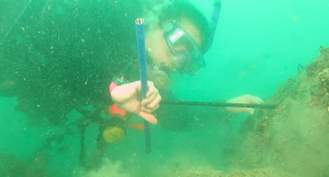 Coring a tree underwater.
Divers found tree stumps on the seafloor about 8 miles offshore of Gulf Shores, Alabama in 2010 when investigating why so many fish gather at this location. The site was found shortly after Hurricane Ivan made landfall in Gulf Shores, Alabama in 2004.The energetic waves from Hurricane Ivan exposed the stumps of baldcypress trees (Taxodium distichum) preserved in their growth position below the seafloor on the northern Gulf of Mexico's outer continental shelf. These in situ stumps are located in 18 m (60 feet) of water and represent the only identified submerged Pleistocene forest assemblage found on the outer continental shelf thus far. In 2013, divers from LSU and Alabama found several previously buried logs and tree stumps emerging from a dark peat sediment ledge with numerous fish swimming among the trees' stumps. They counted more than 50 tree stumps, some up to 1.5 m (5 feet) in diameter with buttresses and knees visible, which are common in baldcypress trees. The divers recovered several pieces of wood and closer examination found the primary cellulose structure intact with no visible indications of permineralization or fossilization by replacement of cellulose with minerals (in other words, the first step in petrifying wood). The majority of the wood specimens retrieved by the divers in 2013 were identified as baldcypress (Taxodium distichum), which is a long-lived tree species (up to 2,624 years) commonly found in coastal and riparian ecosystems from Texas to Delaware.
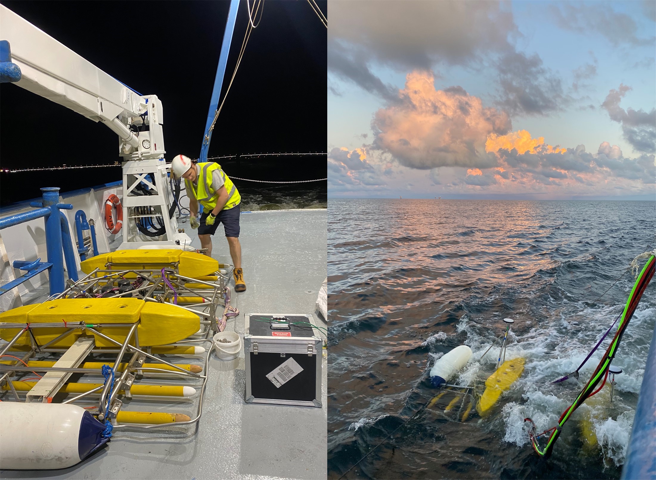
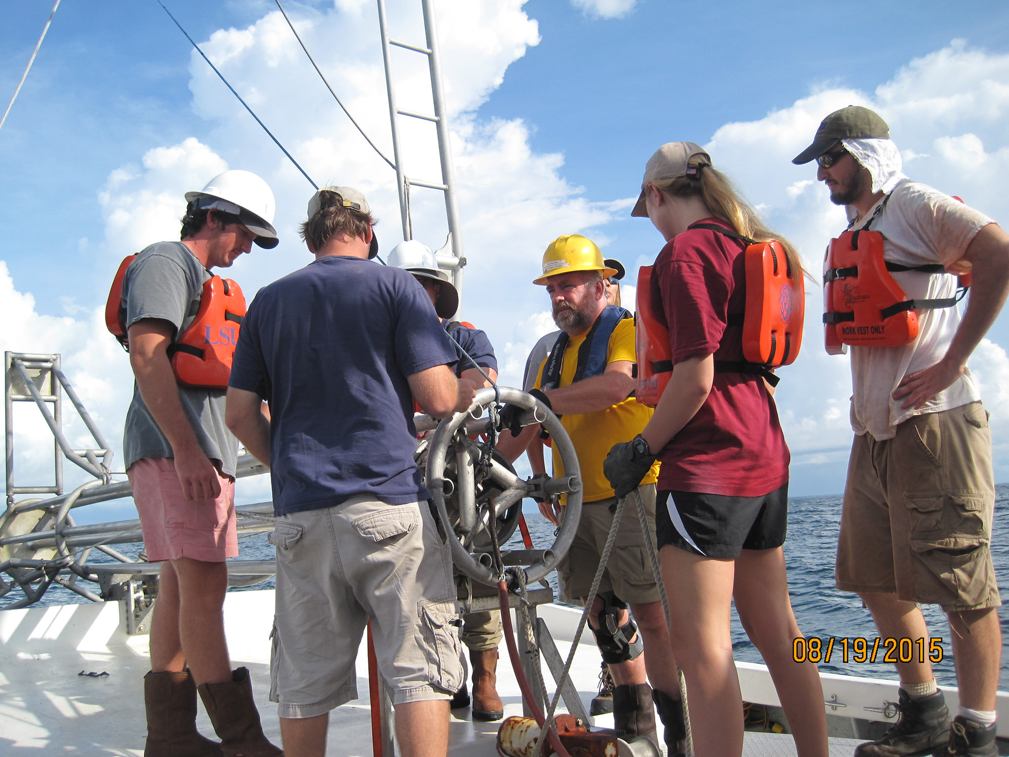 Coring the Alabama underwater forest with students on the Coastal Studies Institute'
s RV Coastal Profiler.
Coring the Alabama underwater forest with students on the Coastal Studies Institute'
s RV Coastal Profiler.In 2015, the Bureau of Ocean Energy Management funded phase one of our study to map the site, document and characterize the sediment and depositional environment, establish an age for the site, develop a geophysical methodology to identify and map buried tree remains, and develop a model to predict other forest sites. Eighteen sediment cores were collected in the study area along with bathymetric and sub-bottom surveys. Radiocarbon dating of the wood and woody remnants in the sediment cores and optically stimulated luminescence dating of the sediments collected from the site suggests the forest's age and burial occurred between 42,000 to 74,000 years ago. These dating results suggest that these trees were alive when global sea level was much lower than today during the glacial interval when the Gulf of Mexico coastline was farther south than today. We hypothesized that rapid increases in global sea level occurring about 60,000 or 40,000 years ago provided opportunities for local floodplain aggradation to bury the baldcypress swamp and preserved the tree stumps. A documentary on phase one of the project was produced by Alabama environmental reporter Ben Raines and can be watch on YouTube.
 Forest site bathymetry and core locations.
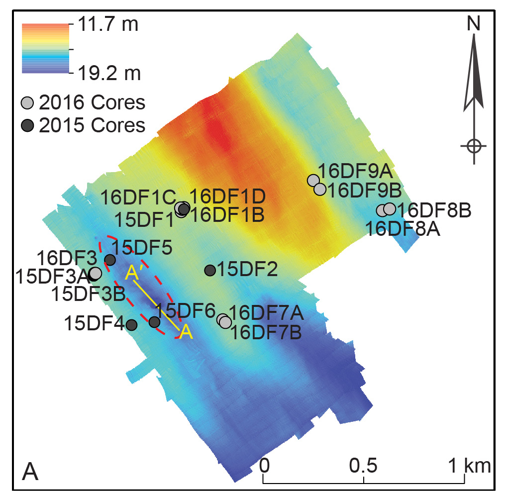
Phase two of the project started in fall 2020 and the projects expanded to other sites found by local researchers. Our 2015 and 2016 bathymetry and sidescan sonar data collected to map the site was able to identify exposed tree stumps; however, the CHIRP sub-bottom acoustic data could not resolve exposed nor buried tree features. To resolve this issue, we used a 3D CHIRP system to resolve the tree stumps still buried at the site in Phase 2. The 3-D CHIRP system is new technology and was used in the Gulf of Mexico for the first time in July 2022 cruise on the R/C Tommy Munro. In phase two, we also gathered more geophysical data from two new sites where stumps were found and one new location where we predicted tree stumps could be found. We also collected for 30 meters of sediment cores in August 2022 from the new sites and the primary site to further our understanding of the processes that lead to the preservation of this forest. The Alabama Underwater Forest represents a rare opportunity to study an accessible Pleistocene landform and to develop a model to identify other possible outer continental shelf locations with still-buried forests. Watch Dr. DeLong's Science Cafe presentation.
 The 3-D CHIRP gear getting setup on the deck of the R/V Tommy Munro and (right) 3-D
CHIRP array being towed off the starboard side.
The 3-D CHIRP gear getting setup on the deck of the R/V Tommy Munro and (right) 3-D
CHIRP array being towed off the starboard side. This project is a joint effort among university researchers, federal partners, and local stakeholders. The team includes Kristine DeLong (LSU Geography & Anthropology), Sam Bentley (LSU Geology & Geophysics), Kevin Xu (LSU Oceanography & Coastal Sciences), Grant Harley (University of Idaho), Andy Reese (University of Southern Mississippi), Jeff Obelcz (Naval Research Laboratory), Alicia Caporosa and Doug Jones (Bureau of Ocean Energy Management), Beth Middleton (US Geological Survey), Zhixiong Shen (Coastal Carolina University), Mark Vardy, Richard Hamilton, and Penda Sisopha of SAND GEophysics, and Ben Raines (AL.com). This project in phase one and two supported or involved undergraduate (Suyapa Gonzalez, Kalab Robertson, and Gavin Blanchard) and graduate students (Suyapa Gonzalez, JT Truong, Jeff Obelcz, Clay Tucker, Kendall Brome, Kelli Moran, Katie Garretson (USM), and Ellen Bergan (University of Idaho)). Additional support for fieldwork included the LSU Coastal Studies Institute, and crew of the R/V Coastal Profiler - Captain Chris Cleaver and First Mate Charlie Sibley, and Bill Gibson, and LSU students Rodney Stieffel, Brianna Crenshaw, Jeff Duxbury, Haoran Liu, Patrick Robichaux, Johnny Ryu, Robin Cobb, Kylie Palmer, Marion Vise, Adam Gartelman, Colin Herke, and Karla Andrea Lizarraga Garcia (USM). Three papers have been published and others are in review as well as the final report to the Bureau of Ocean Energy Management, see Publications.
Peru Short-Lived Bivalves Reconstructing ENSO
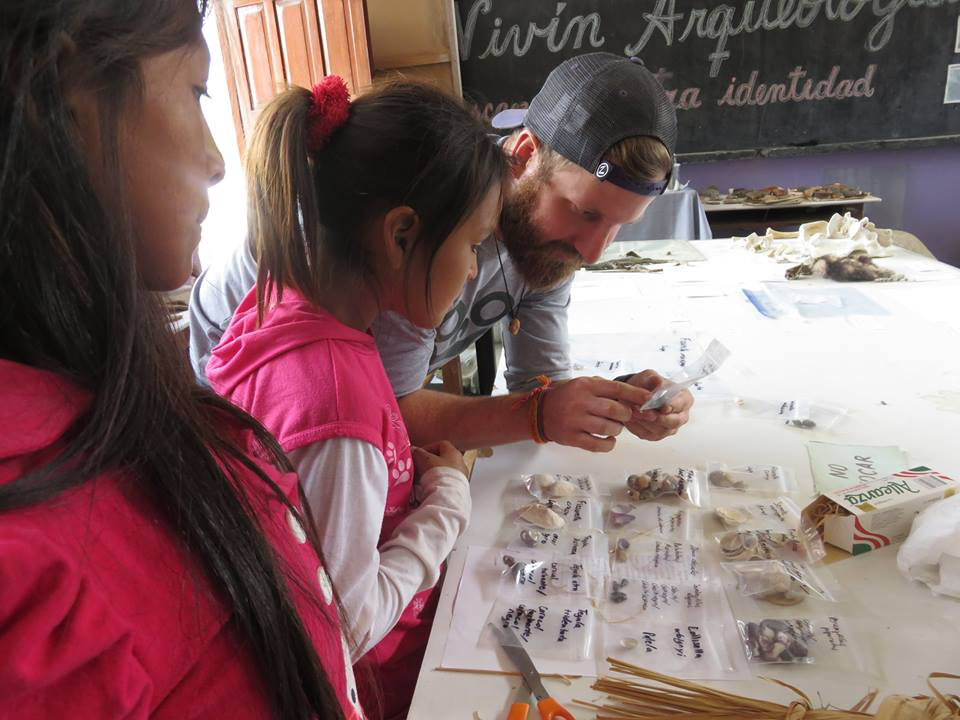 Jacob teaching students in Peru about shells.
El Niño and La Niña events, collectively called the El Niño-Southern Oscillation (ENSO), are the largest source of year-to-year climatic and environmental variability that affects people around the world. For example, El Niños cause droughts in Australia and Southeast Asia while producing damaging floods along the west coast of the United States, Ecuador and Peru. La Niñas produce the opposite effects and both can have significant economic and natural hazard impacts. Recent studies have identified more than one type of ENSO event in the instrumental record, called Central Pacific, Eastern Pacific, or Coastal El Niño events based on the region with greatest rainfall. These different types of El Niños may explain why ENSO reconstructions from the western, central, and eastern Pacific do not always agree. Furthermore, questions remain whether or not this diversity of ENSO events occurred before the 20th century when temperatures were cooler, or occurred during prior warm periods. Our understanding of past and present ENSO is important for refining global climate models used to forecast future climate conditions and in planning for short and long-term impacts from changing climate.
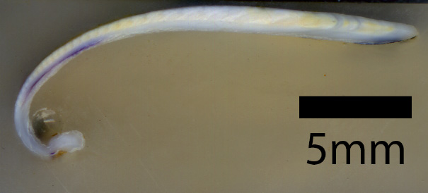 Donax obesulus cross section.
This project leverages the expertise of paleoclimatologists and archaeologists while training students in a multidisciplinary approach that will develop a new reconstruction method that could be used in other locations with abundant shell material. This project will produce a new record of ENSO variability in north central Peru spanning 2800 to 2100 years before present. The study site is an Early Horizon (800 to 100 BCE) archaeological site (Caylán), part of an early urban society in the coastal Nepeña Valley, Peru. The project uses shells from two short-lived bivalve species (Donax obesulus and Mesodesma donacium) excavated from several archaeological units within these sites. These two species have different but complementary habitat preferences (warm versus cold) that make them useful for capturing El Niño and La Niña events; however, both species are short-lived ( less than 5 years). Instead of building a continuous record of individual ENSO events, this project will reconstruct seasonal temperature and salinity variability from modern and archaeological specimens for individual time slices from intra-shell oxygen isotope measurements, similar to the single foraminifer approach used in marine sediment cores. The integration of archaeological data will provide a crucial perspective on the resilience or vulnerability of coastal societies to ENSO variability on long time periods. This project is funded by the National Science Foundation' s Paleo Perspectives on Climate Change program and is supporting the research of doctoral student Jacob Warner. Kristine DeLong and David Chicoine are the principal investigators and several undergraduate students have helped with this project (Dustin Guillot, Ruthie Towns, Kelly Nodurth, and Becky Hood). The first paper from this project is currently in review.
Little Cayman and Holocene Climate in Hurricane Deposits
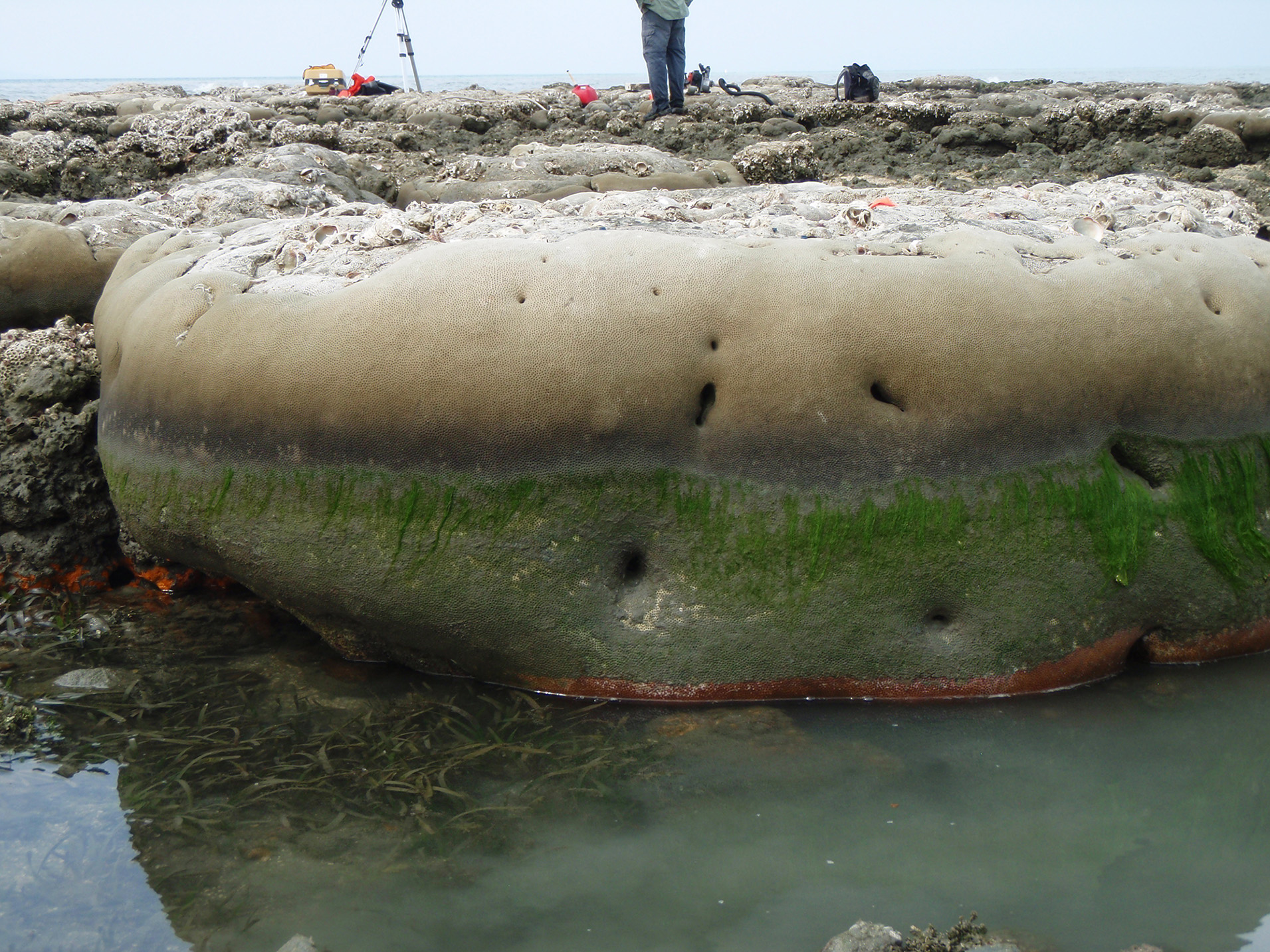
 Coring a boulder in Little Cayman
DeLong and her students have been working in Little Cayman on dead storm deposit corals of the three target species (Siderastrea siderea, Orbicella faveolata and Pseudodiploria strigosa) for the ongoing Holocene coral-based reconstruction project. During our previous field work in 2016 and 2018, we collected 26 S. siderea, 4 O. favelota, and 1 P. strigosa corals. In 2018, we collected 28 of these small coral rocks (we could carry them, < 28 cm long) found on the side of road and 6 were cores (longest was 26 cm) that we removed from large coral boulders on the southwest side of the island and two from the side of the road that were buried in sand. We have dated four of the corals so far; they are 5551, 5685, 3634, and 1248 years old. S. siderea grows about 5 mm per year and the largest storm coral we collected should give us 51 years based on the X-ray images. O. favelota and P. strigosa grow about 7 to 9 mm per year and result in less years for the same size of coral compared to S. siderea, thus why we prefer S. siderea. We also cored dead sections of modern corals in 2016 in order to build a modern comparison data set for our storm corals. Hopefully, in the near future we will be going back to Little Cayman for more fieldwork and coral collection. Our goal with these dead corals is to build a longer record with snapshots of past climate variability in the central Caribbean, which represents the wider Caribbean as a whole, to better understand how climate has changed during the past 6000 years since modern reefs were established. We are analyzing coral Sr/Ca, Mg/Ca, and Ba/Ca using the ICP-OES in the PAST lab.
 Gil coring a buried storm coral in 2018.
This is a longer-term project that Dr. DeLong is leading, and will result in even more knowledge being gained on past reef climate and environmental conditions and tropical storm frequencies in the Cayman Islands. DeLong is working with the Central Caribbean Marine Institute (CCMI) on this project in Little Cayman, where former doctoral student Gil Ouellette spent two summers at CCMI as a mentor and lecturer. Other students working on the project are undergraduate student Kendall Brome and graduate student Jessica Tolan. Kendall is working on two of the S. siderea storm corals and presented her results thus far at the LSU Discover Research Conference in April 2020 and will be presenting her work at the American Geophysical Union Fall meeting in December 2020. Dr. DeLong has presented the modern coral results at the American Geophysical Union Fall meetings in 2019 and 2018. The initial work for this project was partially funded by the Pilot Funding for New Research (Pfund), Louisiana Experimental Program to Stimulate Competitive Research (EPSCoR), The National Science Foundation and the Louisiana Board of Regents.
Hispaniola Modern and Last Interglacial Climate Windows
 Coral microatolls uplifted after earthquake in 2010
On January 12, 2010, the nation of Haiti was rocked by a 7.0 earthquake originating from an epicenter near Léogâne, 25 km west of Port-au-Prince. During this earthquake, several patch reefs of coral microatoll colonies (Siderastrea siderea) growing just off the coast in the Gulf of Gonâve were uplifted out of the sea and died. Five microatoll colonies uplifted in this event were slabbed in the field, and recovered by Dr. Fred Taylor of the University of Texas and colleagues with permission from the government of Haiti for the purpose of paleoseismic analysis. Following the publication of the initial results in the journal Nature Geoscience (Hayes et al., 2010), portions of these slabs were provided to Dr. Kristine DeLong of Louisiana State University for use in further paleoclimatic reconstruction efforts. Coral microatolls are a unique morphology of corals sometimes dismissed as archive sources due to their atypical growth patterns and growing near the water surface. Microatolls have been used for reconstruction in Pacific ocean with Porites corals, but have not been used in the Atlantic Ocean for paleoclimate reconstructions. Former doctoral student Gil Ouellette conducted two studies with the Haiti microatoll corals reconstructing sea suface temperature and tradewinds in the northern Caribbean Sea.
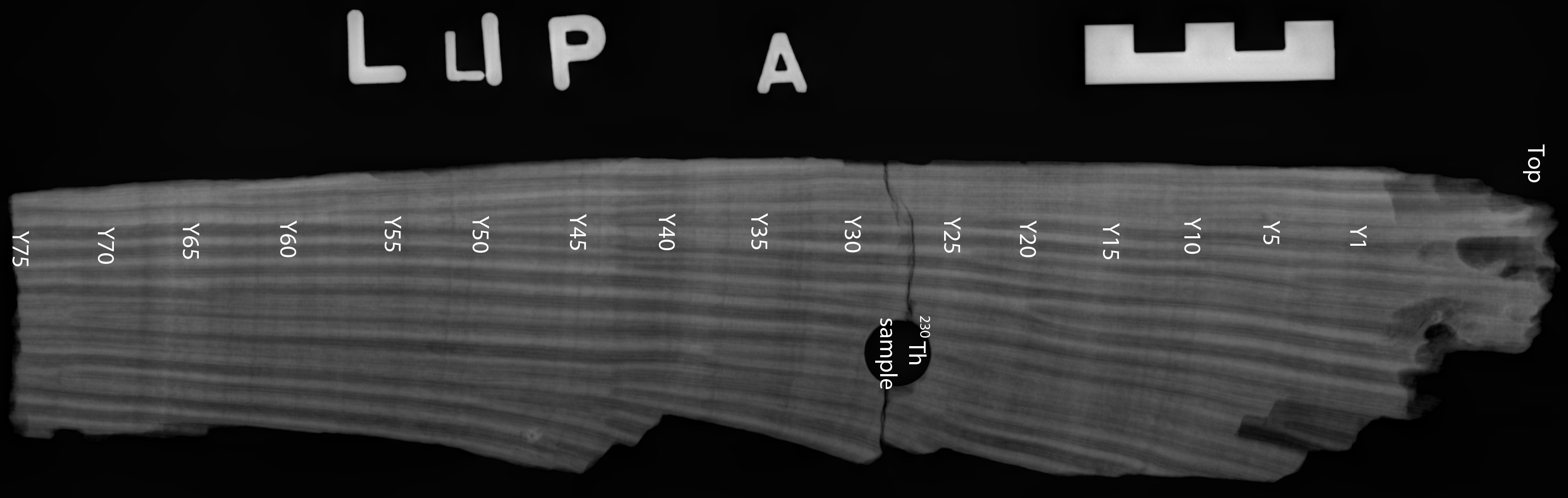 128,618 year old coral x-ray spanning 75 years.
Besides the microatolls in Haiti, the island of Hispaniola, which Haiti is the western side, has several uplifted coral reefs around the island. Fred Taylor at the University of Texas collected several S. siderea from these fossil reefs and has provided to the PAST lab for further analysis. DeLong is working on one coral dated to the Last Interglacial (128,618 years ago) and is reconstructing temperature and examining past multi-decadal variability in the 75-year long coral record. She is working with Dr. Elinor Martin at the University of Oklahoma on climate model simulations for the Last Interglacial to better understand the climate during the last time when the Earth was a warm as today.