Faculty

Xuelian (Shelley) Meng
Dr. Meng is an Associate Professor in the Department of Geography and Anthropology at Louisiana State University. Her research focuses on utilizing various remote sensing technologies, including aerial and satellite sensors, LiDAR, and drones, to extract targeted features and investigate topics such as morphological changes, plant dynamics, disturbances caused by diseases or natural disasters, wetland habitats, precision agriculture, inundation, and 3D reconstruction.
Graduate Students
 Brett A. Patton
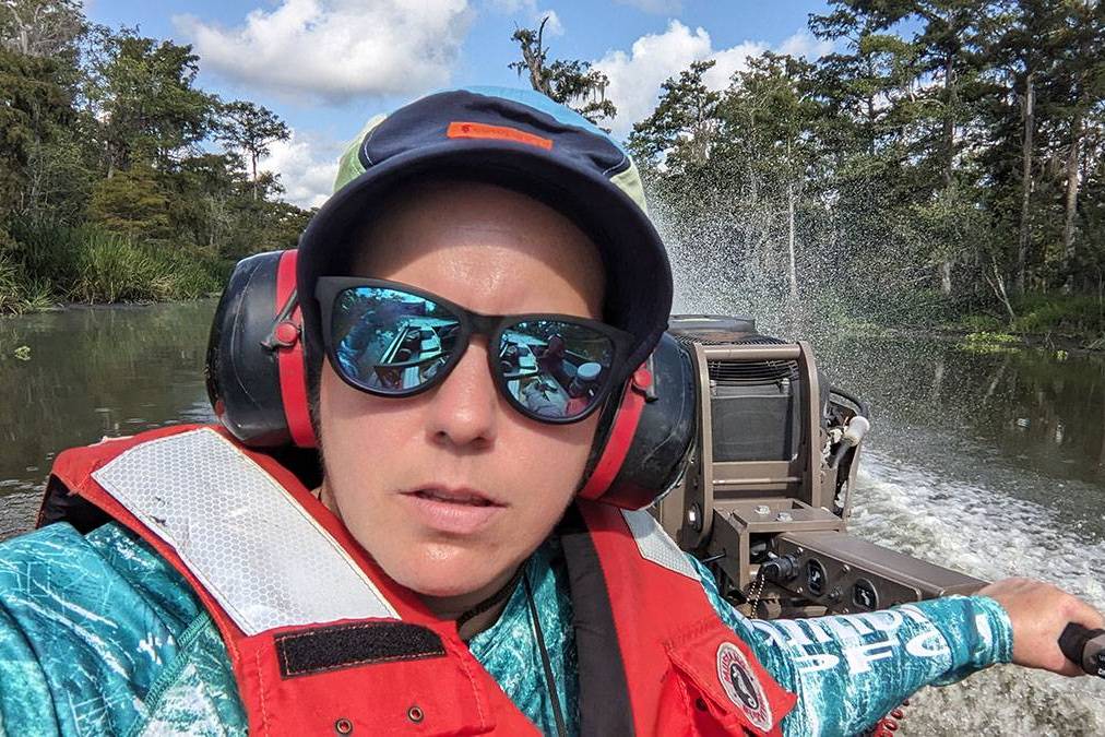
Brett is an ecologist who uses an interdisciplinary approach to address questions related to marsh, barrier island, and forested wetland habitats and wildlife use of those habitats. Brett is a Ph.D. student in the TIGeRS lab, under the guidance of Dr. Meng, with research interests in remote sensing and machine learning applications to advance ecological research. She is particularly interested in sUAS and LiDAR applications for classifying and measuring wetland habitats for bird species of concern. In her spare time, Brett enjoys camping, hiking, pickleball, yoga, playing music, and spending time with her husband, Steven, and their hound dog, Nelson.

Basant Awasthi
Basant is a current Ph.D. student working under Dr. Xuelian Meng. He received his Bachelor of Engineering in Geomatics Engineering from Kathmandu University, Nepal. His research will focus on a multiscale study of the Roseau cane die-off through a combination of UAV, satellite imagery, and field surveys at the Mississippi River Delta. He is interested in utilizing modern-day machine learning and deep learning techniques in his research. Apart from academics, he likes to watch anime, travel, and cook.
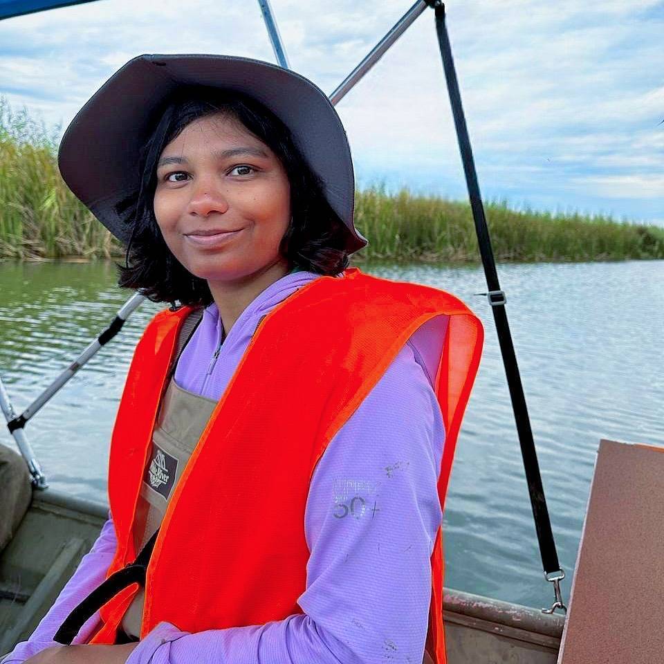
Bijaylaxmi Sahoo
Bijaylaxmi is a Ph.D. student in the TIGeRS lab working with Dr. Xuelian Meng. Having dual master's degrees in Atmospheric Sciences and Oceanography and work experience in LULC study, she is skilled in remote sensing of land, ocean, and atmosphere. She recognizes herself as a meteorologist and has a passion for cloud photography. She is investigating the health of Roseau Cane in the Louisiana wetlands from remote sensing aspects.
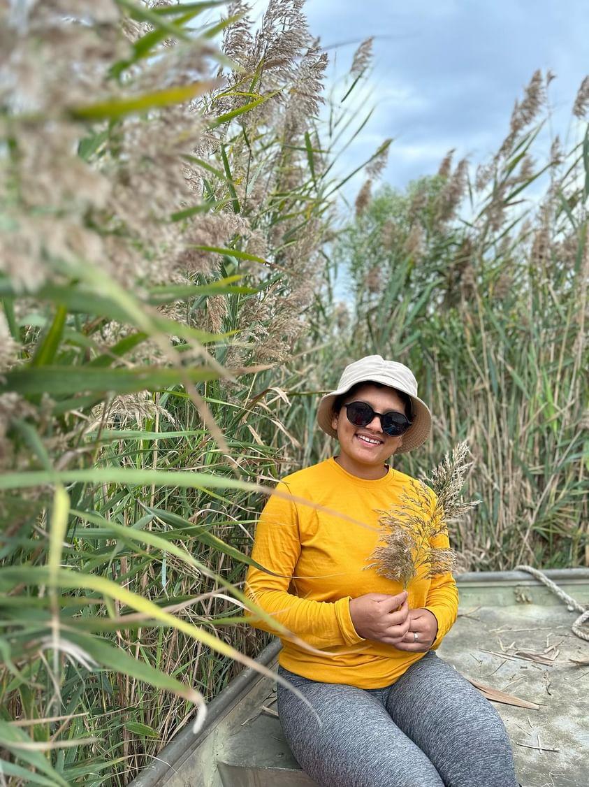 Manisha K C
Manisha is a native of Nepal and a master’s student at Louisiana State University, majoring in Geography. She is working as a Graduate Research Assistant in TIGeRS Lab under the guidance of Dr. Meng, where her focus revolves around the appealing realm of remote sensing to advance wetland restoration and agricultural research. Currently, she is dedicated to investigating the dieback of Phragmites australis, the dominant marsh grass in Louisiana's Rockefeller, to identify the physiological factors, salinity, and historical changes over the years using multi-temporal and multi-spatial remote sensing data. Simultaneously, she is also involved in image classification for predicting Rye-grass production, contributing valuable insights to agricultural practices. Her research interests are Remote Sensing, Digital Image Processing, Photogrammetry, Spatial Analysis, and Agriculture. She is eager to contribute to this innovative research landscape and harness the power of remote sensing to unearth insights and make meaningful contributions to our understanding of the world. Beyond academia, she is a travel enthusiast, loves hiking, photography, cooking, gardening, and always seeks new challenges.
 Sudeep Kuikel
Sudeep is currently pursuing a Master’s Degree at the Department of Geography and Anthropology, Louisiana State University, under the supervision of Dr. Meng. He is passionate about Geospatial Innovation. He has a strong knowledge of GIS, Photogrammetry, and Remote Sensing. He is very much interested in unleashing the power of spatial analysis and transforming agricultural sectors and disaster risk management through cutting-edge technologies to map the future with precision and purpose.
 Mizbah Ahmed Sresto
Mizbah is from Bangladesh and is currently pursuing an M.S. in the Department of Geography & Anthropology at Louisiana State University (LSU) under the supervision of Dr. Xuelian (Shelley) Meng. He aims to focus on environmental research using geospatial technology and machine learning techniques to address challenges related to natural hazards and landscape ecology. He is particularly interested in utilizing various imaging platforms, such as Unmanned Aerial Vehicles (UAVs), satellites, multispectral imaging sensors, and Digital Elevation Models (DEMs), for applications including land use and land cover transformation detection, heat island zoning, hazard mapping, and water resource management.
 Sanjoy Roy
Sanjoy is currently a PhD student in the TIGeRS Lab at Louisiana State University, under the guidance of Professor Xuelian (Shelley) Meng. His research interests lie at the intersection of remote sensing and GeoAI, focusing on exploring the dynamic interactions between physical and human environments. He holds a BS and an MS in Geography and Environment from the University of Dhaka, Bangladesh. Additionally, as an Erasmus Mundus scholar, he obtained a second Master’s degree in Marine Spatial Planning through a joint program across three European universities in Spain, Portugal, and Italy. He has contributed to research initiatives in several Bangladeshi and international organizations, including IUCN, IOC-UNESCO, and CNR-ISMAR. In addition, he collaborates with the Landscape Management Research Group at the University of Girona, Spain, on research and publications. His doctoral research focuses on applying UAV-based remote sensing for biomass modeling in the pasturelands of Louisiana, a significant project supported by the U.S. Department of Agriculture.
Lab Alumni
Xukai Zhang, Ph.D., 2019
Yirui Deng, Master, 2019
Anliu Jiang, Master, 2017
Nan Shang, Ph.D., 2022
Past Visiting Scholars
Chong Huang
Feng Li, Institute of Disaster Prevention

Hui Sheng, China University of Petroleum
Yong Xu, South China Agricultural University(SCAU)
Haitian Zhu, National Satellite Ocean Application Service (NSOAS), State Oceanic Administration (SOA)