Research

We have active ongoing research in the following areas.

  1. Coupled Fluid and Heat Flow and Reactive Transport Modeling for Predictive Wellbore Integrity
    from Fluid-Rock-Cement Interactions


    Geochemical interactions leading to increased porosity—thus compromising wellbore integrity—along the cement–rock interface in Gulf of Mexico-like subsurface conditions.
    The porosity contour plots visualize how porosity changes in the cement-rock-brine system, where light Yellow/Beige shades indicate lower porosity and darker Orange to Brown tones represent higher porosity. (Left) plots show porosity evolution due to geochemical interactions in different wellbore-cement-brine systems under varying salinity and organic content. Geochemical interactions leading to increased porosity thus compromising wellbore integrity—along the cement–rock interface in Gulf of Mexico-like subsurface conditions. (Right) schematic shows a vertical well intersecting multiple gas and water sand layers, with cement plugs and casing layers isolating the formations. Adapted from: Ajayi, T., & Gupta, I. (2021). Long term assessment of the geochemical integrity of offshore wellbore cement – Results from numerical modeling. Journal of Petroleum Science and Engineering, 201, 108443.
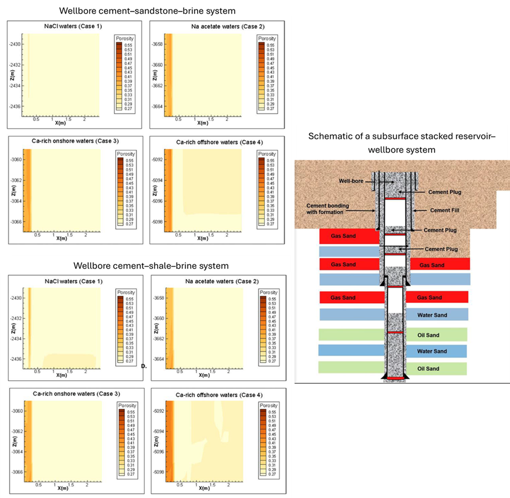
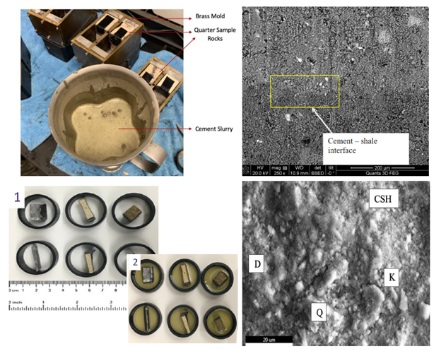
  2. Investigating Geochemical Wellbore Integrity using Experimental and Analytical Techniques


    The (top left) image shows freshly mixed cement slurry in a mold prior to curing at BJ Services Lab in Tomball (2019). The (bottom left) images display samples used for microhardness testing, before (1) and after (2) embedding in epoxy resin. SEM image showing microstructural interface between cement and shale with labeled phases.
    The (top left) image shows freshly mixed cement slurry in a mold prior to curing at BJ Services Lab in Tomball (2019). The (bottom left) images display samples used for microhardness testing, before (1) and after (2) embedding in epoxy resin.


  3. Underground Hydrogen Storage


    3D hydrogen distribution plots showing effect of boundary conditions and formation dip on hydrogen withdrawal performance.
    The figure maps hydrogen saturation after withdrawal in aquifers with different dip angles ranging from 0° to 60°, (showing in each row) under two boundary conditions (showing in each column): finite-acting and infinite-acting. Greater dip in finite boundaries promote higher recovery and better gas sweep. Legend shows the hydrogen saturation ranging from 0 to 0.6. Adapted from: Zamherian and Gupta, 2025, Impact of well flow dynamics and formation characteristics on underground hydrogen storage in aquifers, International Journal of Hydrogen Energy, Volume 109, 2025, Pages 995-1007, https://doi.org/10.1016/j.ijhydene.2025.02.161.


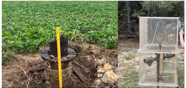
  4. Methane Emissions & Well Characterization – Orphan Wells


    Photo of corroded wellhead at abandoned site; flux chamber for methane measurement on field site
    Images show field measurements of methane emissions at abandoned orphan wells. (Left) Corroded well head from abandoned well. (Right) Flux chamber measurement of methane emissions from orphan wells in Louisiana. Picture courtesy: Frank Driscoll and Kanchan Maiti (LSU). Our group (Gupta - GMG) analyzes methane measurements vis-à-vis well and reservoir characteristics.


  5. Geological Carbon Storage – Monkey Island, Louisiana


    Licensing for Carbon Capture and Storage (CCS) wells is advancing rapidly in Louisiana. A key site for planned storage
    is
    Monkey Island, the location of the Monkey Island Carbon Storage Project (MICSP), commercially known as GeoDura.
    This
    project is part of the U.S. Department of Energy’s CarbonSAFE Phase III initiative, with over $26 million in funding-
    primarily from the DOE. GeoDura is led by Advanced Resources International, Inc. (ARI), in collaboration with CarbonVert,
    Louisiana operator Castex, Louisiana State University (LSU), the Southern States Energy Board (SSEB), and the Bureau
    of
    Economic Geology (BEG). The commercial partner, OnStreamCO₂, is a joint venture between Castex and CarbonVert.
    GeoDura Carbon Storage Hub. Source: Project Landing Page | netl.doe.gov
    The project aims to establish a commercial-scale geologic CO₂ storage hub in Louisiana state waters near Monkey Island, capable of transporting and storing up to 9 million metric tons of CO₂ per year. Activities will include a comprehensive site assessment, permitting for UIC Class VI injection wells, and the development of both the storage field infrastructure and
    a robust community engagement plan. Our group is investigating cement-rock-fluid geochemical interactions to assess
    and ensure long-term barrier integrity of CCS for MICSP.


  6. Lithium Characterization from Oil Field Brines


    In collaboration with the Idaho National Laboratory (INL)/Battelle Energy Alliance and funded by the U.S. Department of Energy’s Geothermal Technologies Office, we are investigating the potential for critical minerals—specifically lithium-in produced waters from oil and gas wells in the Louisiana’s Smackover Formation. Lithium (Li) production is a global priority
    due to its essential role in battery technologies and clean energy systems. The Smackover Formation, which spans from
    Texas to Florida and crosses into northern Louisiana, is a promising but understudied source. While lithium concentrations exceeding 400 ppm have been reported in brines from the Smackover in southwest Arkansas, the Louisiana segment
    remains largely unexplored.


Sponsors

Baker HughesUS Department of the Interior     Idaho National Laboratory   Innovation in Research

Gulf Research ProgramRegents      Louisiana Department of Energy and Natural Resources     USGS

Department of Energy       Binational Industrial Research and Development FoundationBureau of Ocean Energy ManagementLSU_College of Engineering

Halliburton