Equipment
The TIGeRS Laboratory is established recently in the Geography & Anthropology Department and there are separate cubicles assigned for graduate students to conduct research. In the same building, necessary equipment are stored and maintained.
DJI Matrice 600 Pro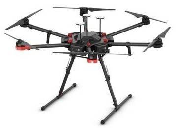
The TIGeRS Lab stores the Matrice 600 pro equipped with a 10 band Micasense RedEdge camera. The drone with six intelligent Flight Batteries has a flight time of about 30 minutes and advanced intelligent flight functions, ensuring safe and stable operation at all times. The drone is reliable for mapping purpose in areas with relatively high wind intensity such as wetlands and coastal areas.
Micasense RedEdge Dual Camera
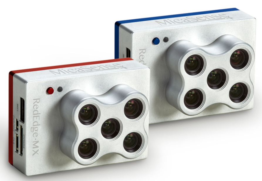
RedEdge sensor is a ten-band multispectral camera fixed with Matrice 600 pro. The
blue,
green, red, red-edge, and NIR bands were optimal for vegetation health monitoring.
DJI Matrice 300 RTK & Zenmuse L1 LiDAR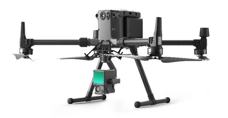
The Zenmuse L1 integrates a Livox Lidar module, a high-accuracy IMU, and a camera with a stabilized gimbal. The DJI M300 Drone, when used with DJI Terra, it gives real-time 3D data and RGB aerial images simultaneously. Incorporating GNSS data, high-accuracy IMU, and vision sensor for positioning accuracy allows for centimeter-level accuracy.
Trimble R10 GNSS Receiver
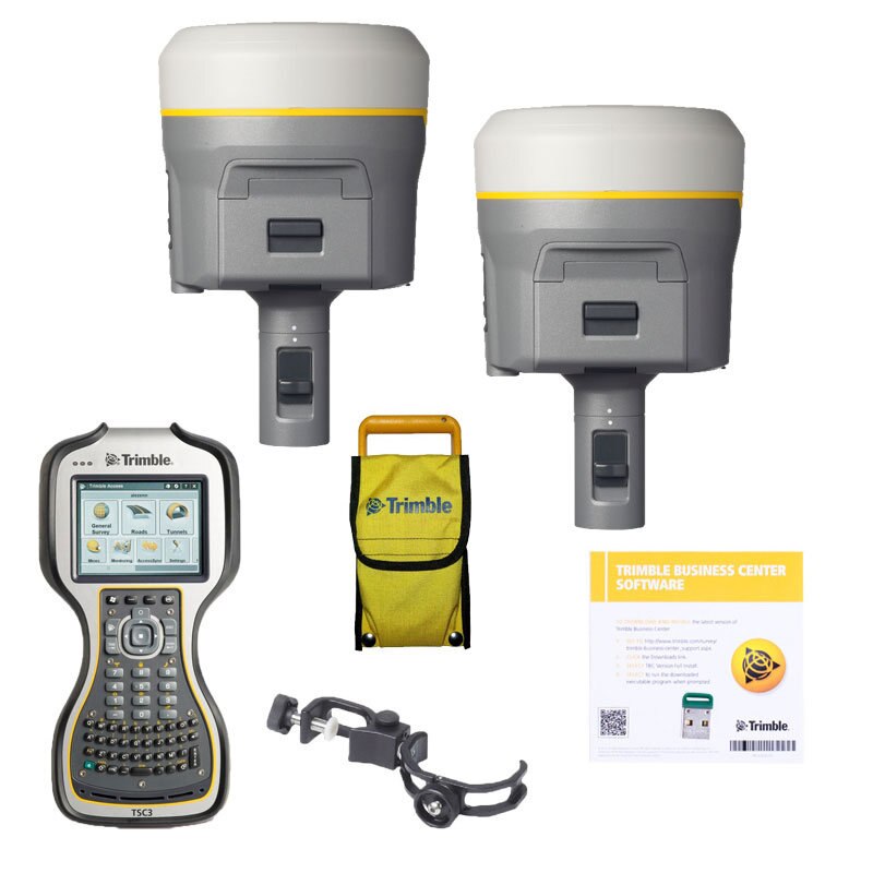 The R10 receiver with advanced satellite tracking with Trimble 360 receiver technology
provides centimeter-level positional accuracy. The receiver incorporates a GNSS antenna,
receiver, internal radio, and battery in the box. The base and the rover can be set
up quickly and is ideal for any size job site. Additionally, the data from the RTK
survey can be processed using the licensed software Trimble Business Center.
The R10 receiver with advanced satellite tracking with Trimble 360 receiver technology
provides centimeter-level positional accuracy. The receiver incorporates a GNSS antenna,
receiver, internal radio, and battery in the box. The base and the rover can be set
up quickly and is ideal for any size job site. Additionally, the data from the RTK
survey can be processed using the licensed software Trimble Business Center.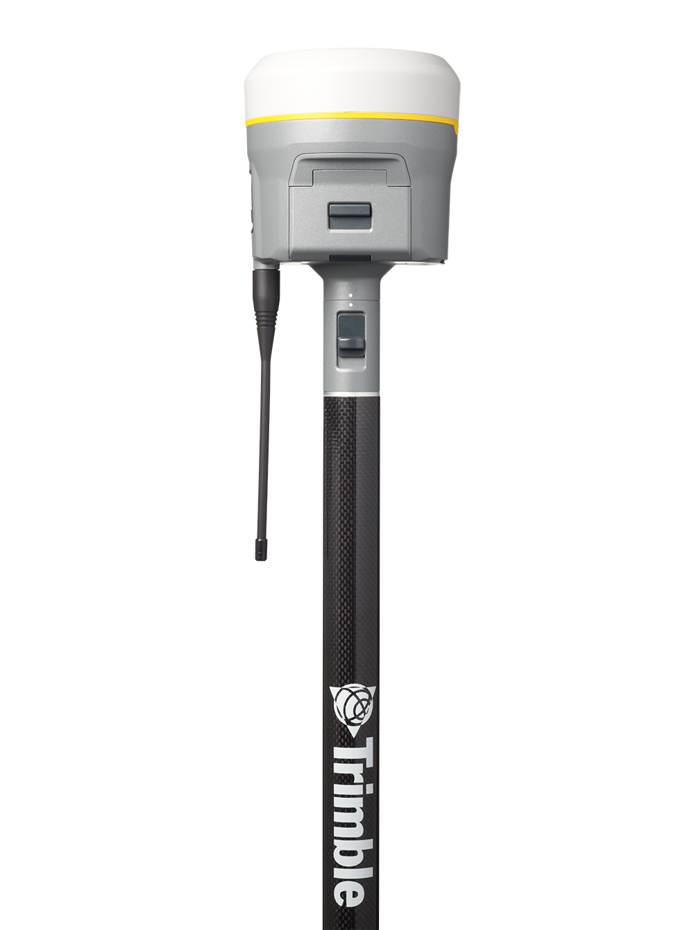
DJI Phantom 4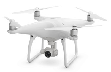
The TIGeRS lab stores five Phantom 4 drones. It is an extremely smart flying camera able to intelligently track objects without a separate device, avoid obstacles and fly with a tap of your finger. In addition, the Phantom 4 provides crisper and cleaner photos with a 12-megapixel RGB camera. We used Phantom 4 for the quick preliminary survey and plant sampling in inaccessible locations.
DJI Phantom 4 Pro V2.0
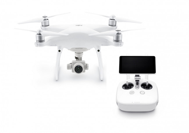 The TIGeRS lab stores five phantom 4 pro v2.0 drones. They are similar to the phantom
4 with advanced 20-megapixels CMOS sensors, 5- direction obstacle sensors, and a built-in
screen in a remote controller.
The TIGeRS lab stores five phantom 4 pro v2.0 drones. They are similar to the phantom
4 with advanced 20-megapixels CMOS sensors, 5- direction obstacle sensors, and a built-in
screen in a remote controller.
Terrestrial Lidar Scanner RIEGL VZ-100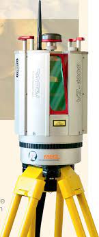
The terrestrial Lidar scanner RIEGL VZ-1000 is a compact and lightweight surveying instrument, mountable in any orientation and able to perform in limited space conditions. It provides high-speed, non-contact data acquisition using a narrow infrared laser beam and a fast-scanning mechanism. The fully portable, rugged, and robust instrument offers a wide field of view of 100° vertical and 360° horizontal and uses an invisible laser beam for eye-safe operation in Laser Class 1.
FLIR Duo Pro R Thermal Camera
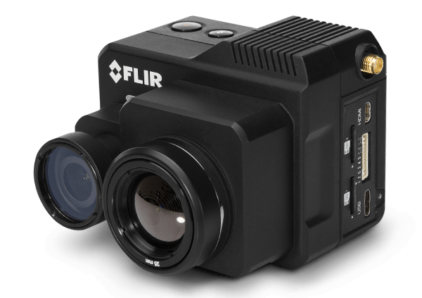
The thermal camera transforms any airframe into an industrial tool, expanding its value and uses. The camera features thermal and a high-definition 4K color video in a single integrated package, enabling the ability to capture actionable thermal and visible data in a single flight. In addition, the onboard GPS receiver, IMU, temperature, humidity, and altitude sensors help to get accurate metadata for every image.